A Geography Post
First, some geography-related mnemonic devices (donkey bridges!):
Baltic States: The countries are in alphabetical order (Estonia, Latvia, Lithuania) from north to south.
Paraguay/Uruguay: Also in alphabetical order from north to south.
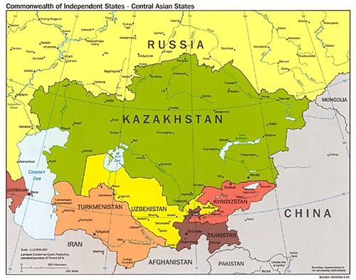
Turkmenistan and Co: I tend not to have any trouble remembering where Kazakhstan, Afghanistan, and Pakistan are located, but Turkmenistan, Tajikistan, Uzbekistan, and Kyrgyzstan are a little more tricky. Of the four, Turkmenistan and Tajikistan (which both start with a "T") are the southernmost countries. Turkmenistan is the one closer to Turkey. Kyrgyzstan, having a rather cramped name, is a comparatively small country (i.e. the one to the north of Tajikistan). All that remains is Uzbekistan, which is the country north of Turkmenistan.
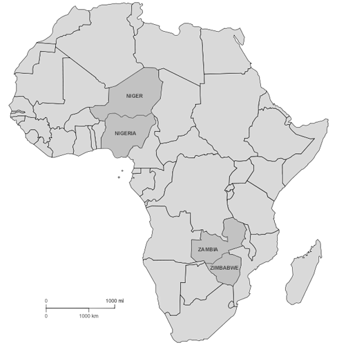
Niger/Nigeria and Zambia/Zimbabwe: In both cases, the shorter name corresponds to the northernmost country.
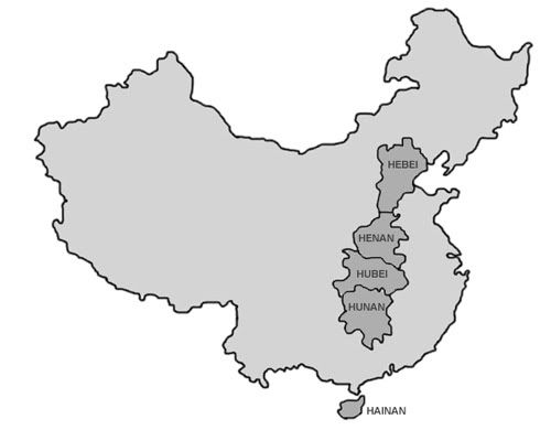
Chinese Provinces: Hebei, Henan, Hubei, Hunan, and Hainan form an exclamation mark of sorts. Note that the first two start with "He", while the second two start with "Hu". The endings alternate between "bei" and "nan". (Incidentally, Shaanxi and Shanxi are side by side, just west of Hebei. Shaanxi, having the longer name, is the larger of the two provinces. Not included on the map, unfortunately.)
Next, some look-alikes:
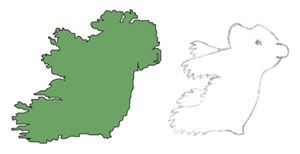 |
| Ireland: a bear |
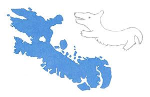 |
| Baffin Island (upside down): a dachshund |
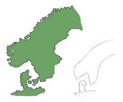 |
| Scandinavia: a snake eating a worm |
Finally, two geography quiz links:
The first has a variety of quizzes, among them many province or state quizzes (e.g. for the US, Russia, China, Japan, and Iraq). The main disadvantage is that you have to manually click "Next Question" each time. :.o(
The second is a timed world map quiz. It is possible to zoom in for some of the smaller countries, but I wouldn't recommend it, since it probably wastes valuable milliseconds of time. :o) One of the advantages (or, perhaps, disadvantages) of this quiz is that you are presented with the official names, rather than the common names (e.g. Hellenic Republic instead of Greece, and Democratic Republic of Korea rather than North Korea).
Note: The map of Central Asia was taken directly from the Perry-Castañeda Map Collection. The map of China is based on a map from Chinatown Connection, and the map of Africa is based on a Wikimedia Commons map. Baffin Island was taken directly from a map in the National Geographic Atlas of the World, while Ireland and Scandinavia were traced from maps in the same atlas.

0 Comments:
Post a Comment
<< Home